 |

|
|
|
History of the Cornfeld/Cornfield |
|||
Kornfeld/Cornfeld/Cornfield
The first white settlers to the area spoke German and used the German word "Kornfeld" (Cornfield in English), to describe/label the area. That became official when John Schofer opened the Post Office with the name "Cornfeld", on November 1, 1913.
They were probably using the original meaning of the word corn, which is a general term for any seed crop, especially a cereal crop. Only in North American do we call maize, corn.
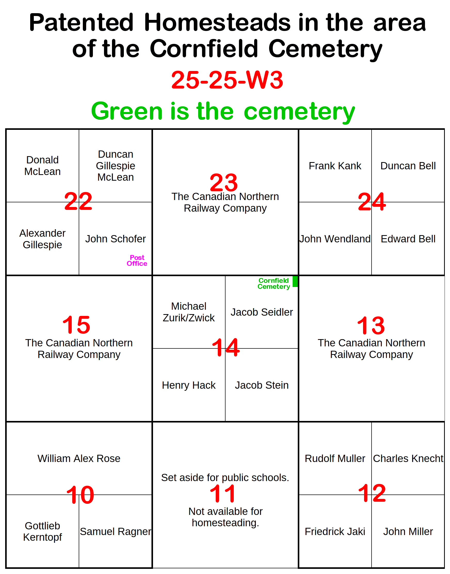
NE-14-25-25-W3 | |
The Saskatchewan homestead records given here are from | |
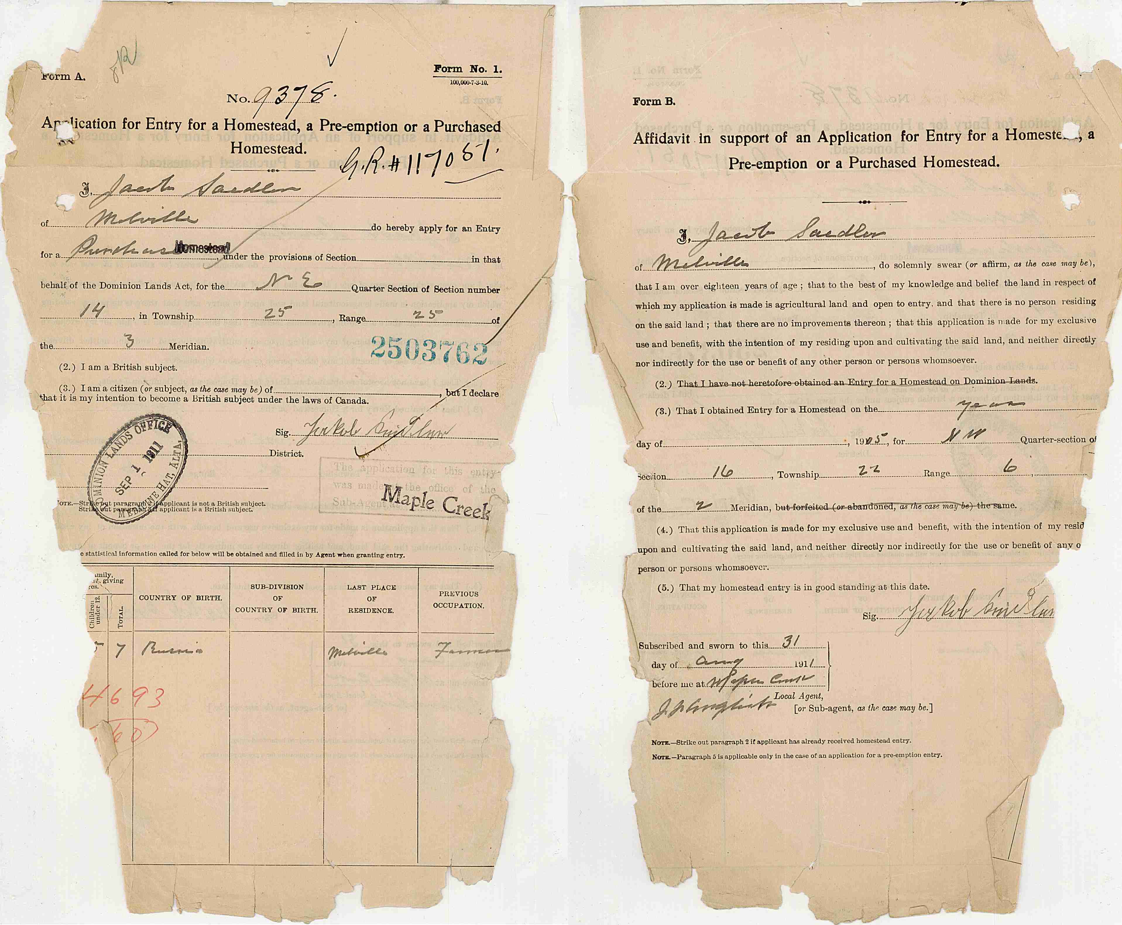
| 1911-Aug-31: Jacob Seidler applied for Homestead entry for NE-14-25-25-W3. |
|
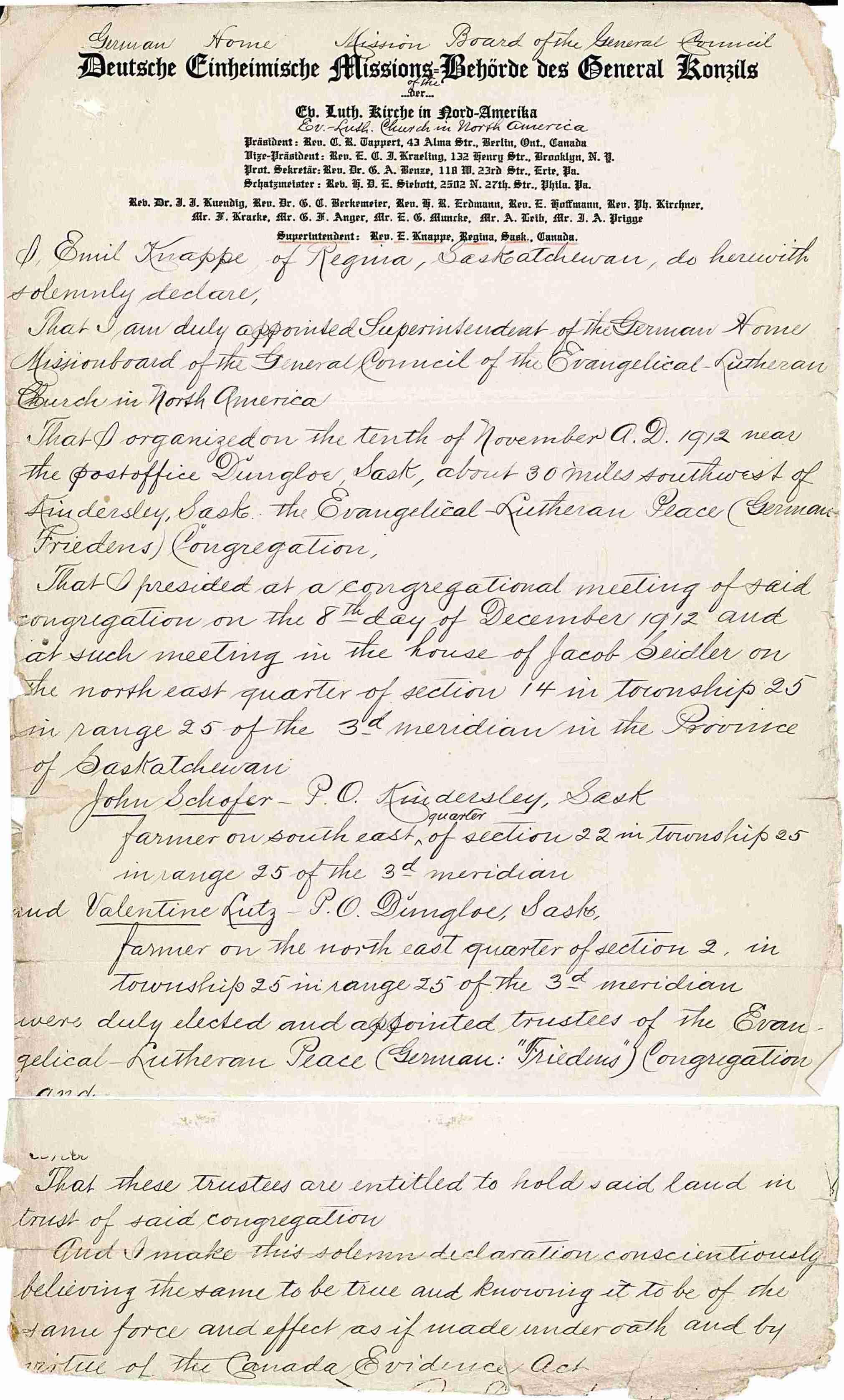
| 1912-Nov-10: The "Evangelical-Lutheran Peace Congregation" was organized. 1912-Dec-08: Trustees appointed and are entitled to hold land in trust of the congregation. |
|
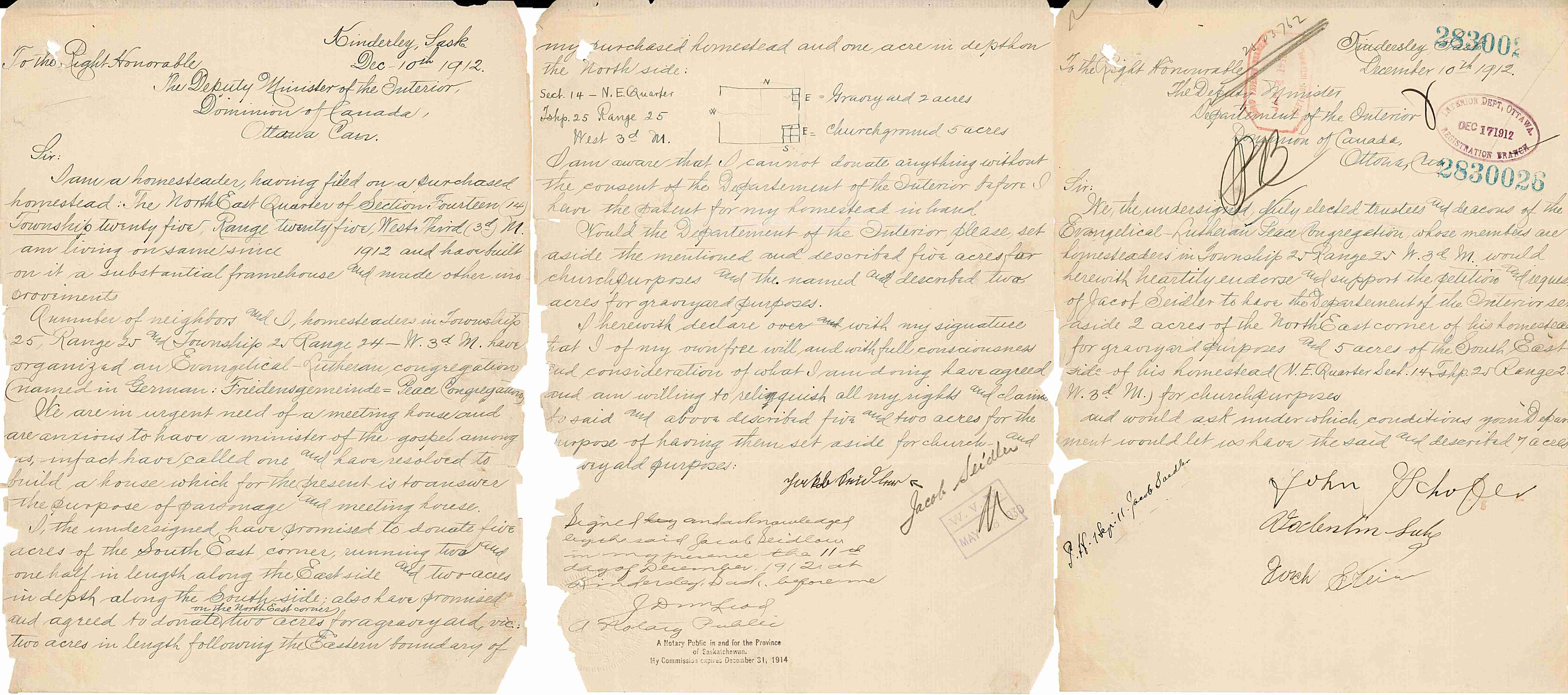
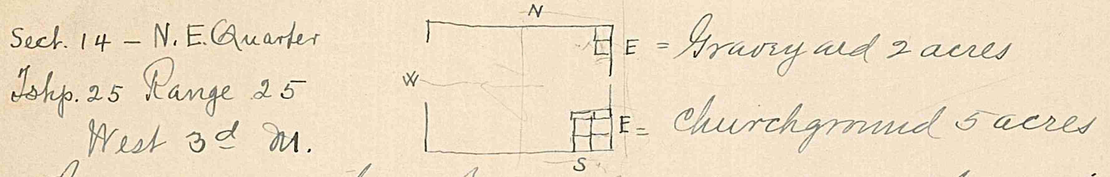
| 1912-Dec-10: Jacob Seidler & the Evangelical-Lutheran Peace Congregation wrote to the Department of the Interior asking how he can give parts of his un-patented homestead for a church and a graveyard. |
|
|
|
| 1913-Nov-01: Cornfeld Post Office opens on 22-25-25-W3 John Schofer as Postmaster. He would have been handing out mail from his house in the southeast quarter of that section. |
 |
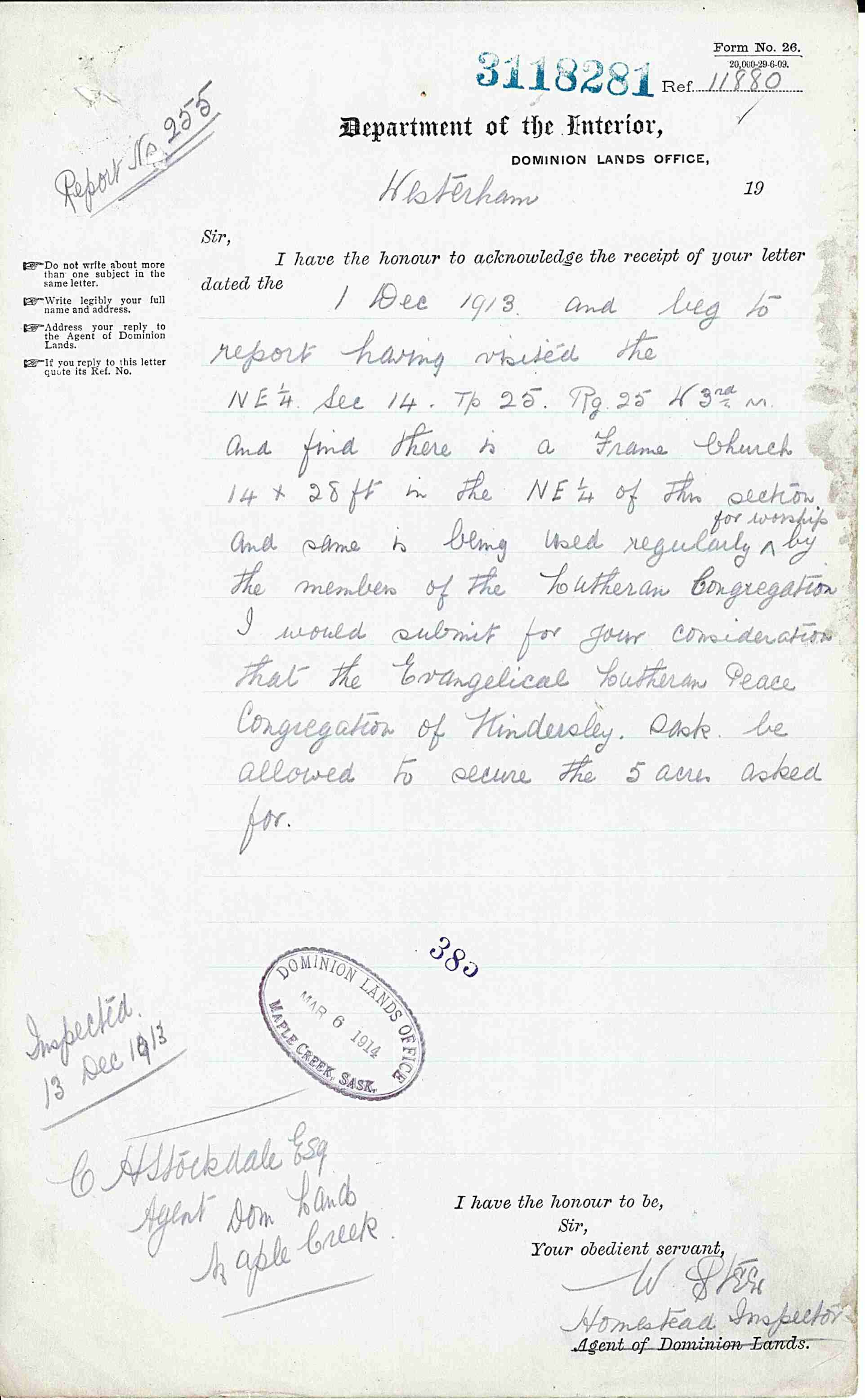
| 1913-Dec-13: Homestead Inspector to Department of the Interior Visited the property. Found Frame Church 14 x 28 feet, being used regularly for worship. Recommend they get the land grant. |
|
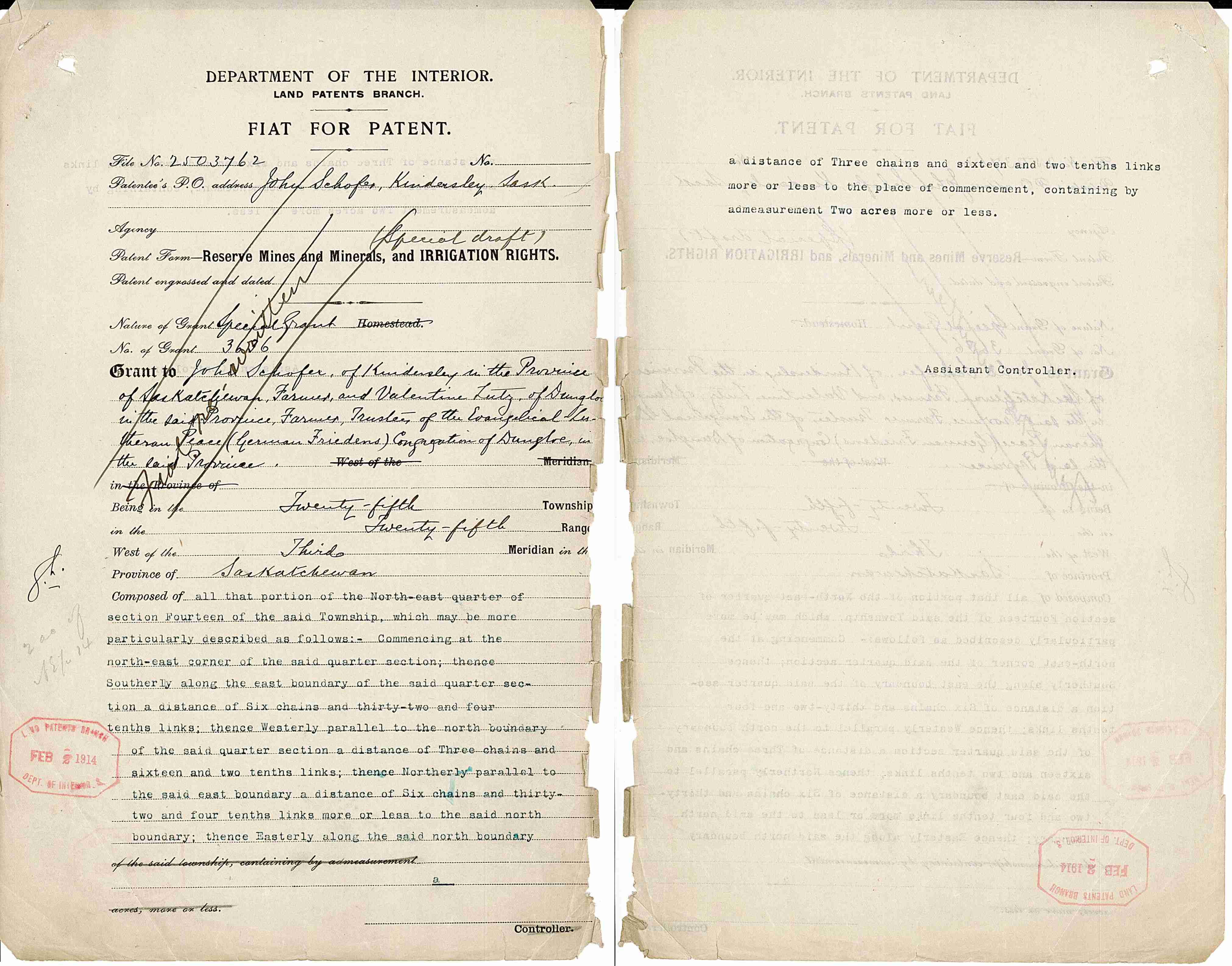
| 1914-Feb-02: Specifics of cemetery land described. In the NE corner of NE-14-25-25-W3. 2 acres measuring: N-S: 417 feet, 4.6 inches (127.218 metres) E-W: 208 feet, 8.3 inches (63.609 metres) |
|
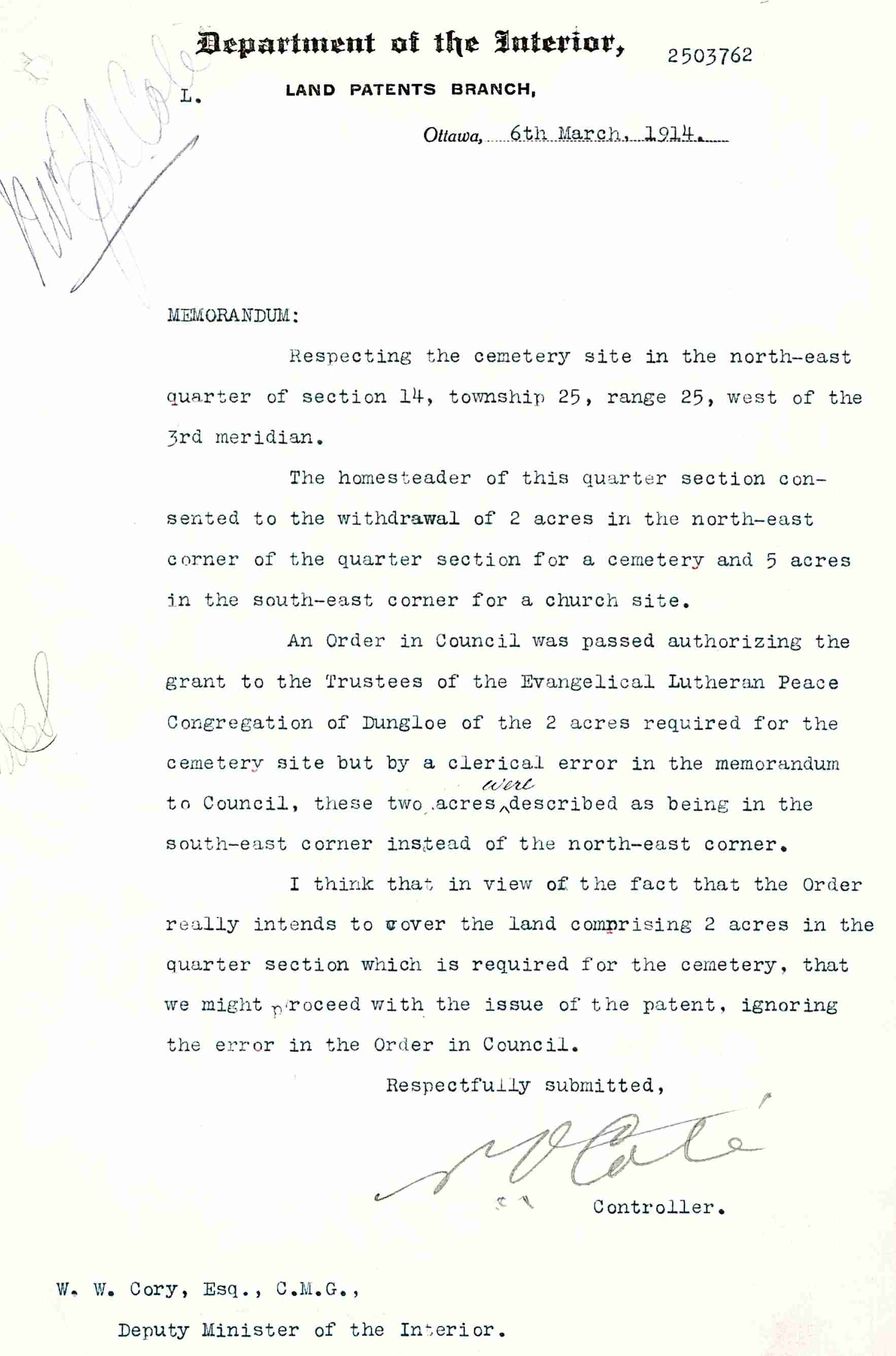
| 1914-March: Clerical error The cemetery is in NE corner, not SE corner. 5 pages of memorandums about it. |
|
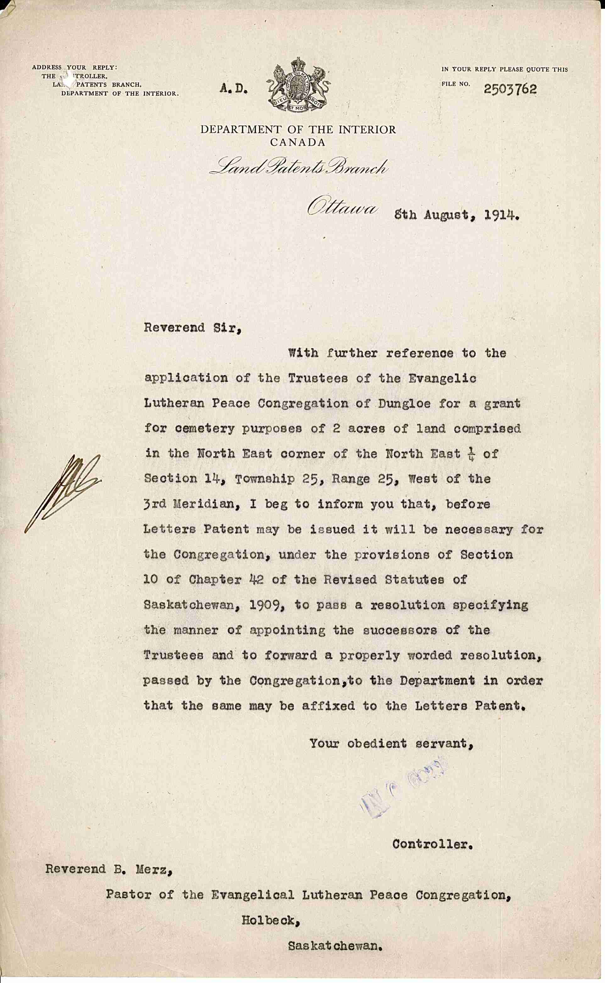
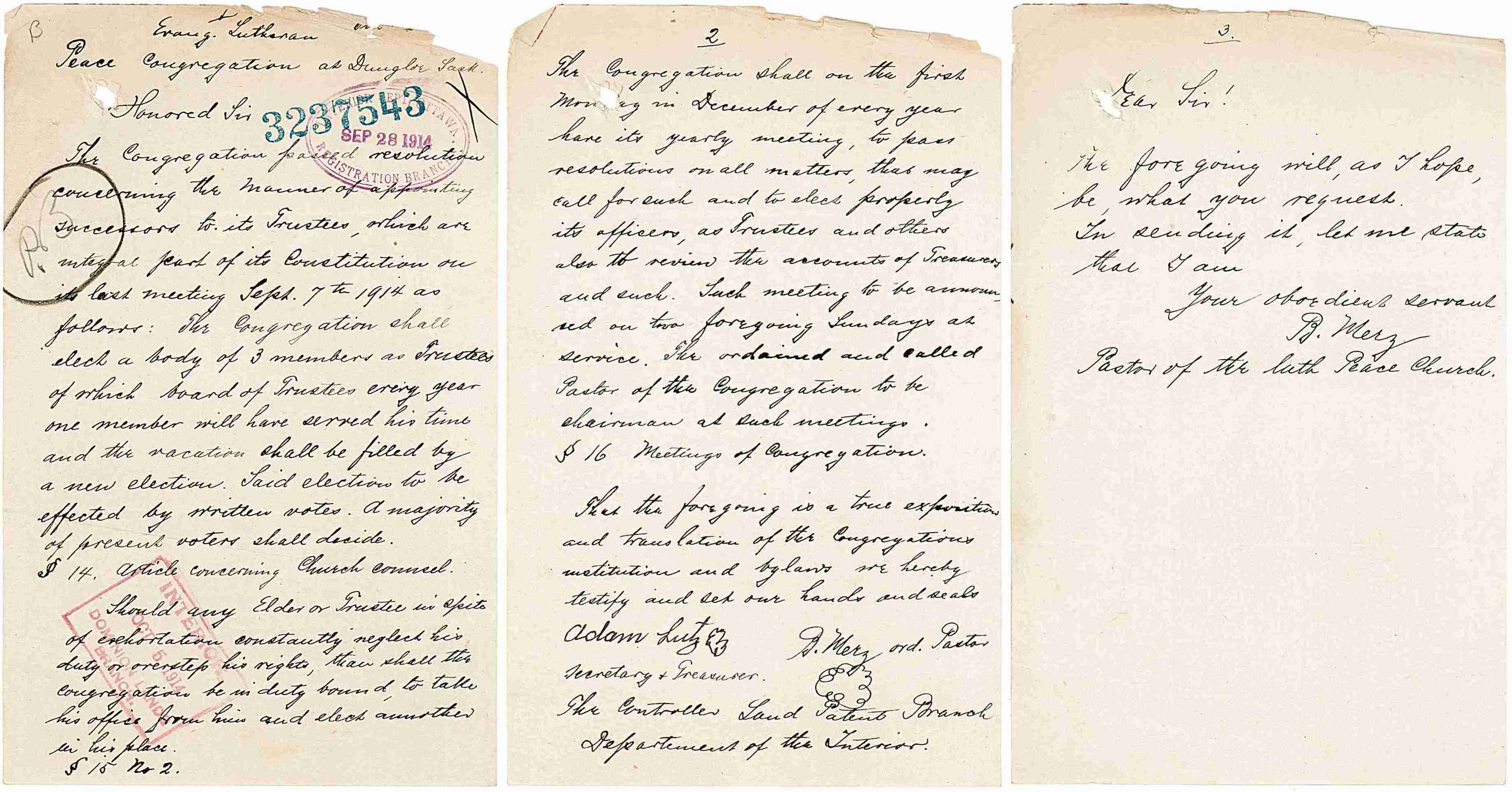
| 1914-Aug-08: Everything in order, BUT your Congregation needs to pass a resolution for appointing succeeding Trustees. |
|
| 1914-Sep-28: Congregation passed resolution concerning the manner of appointing successors to its Trustees |
|
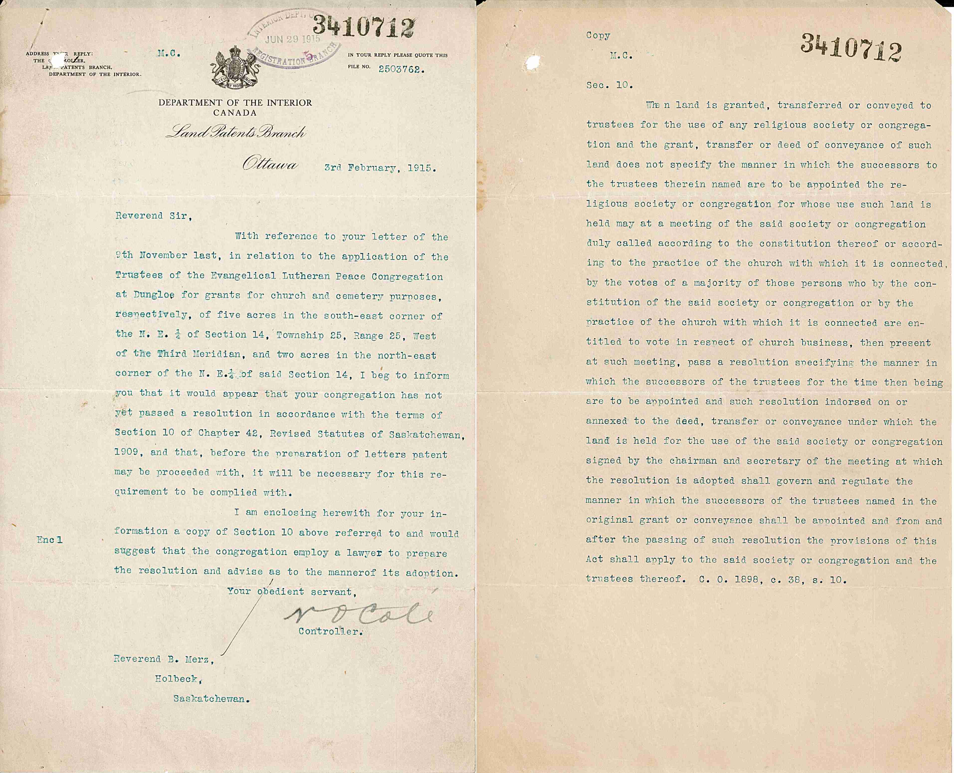
| 1915-Feb-03: Previous communication not good enough. You need to supply a properly worded resolution by your congregation regarding the appointment of future Trustees. |
|
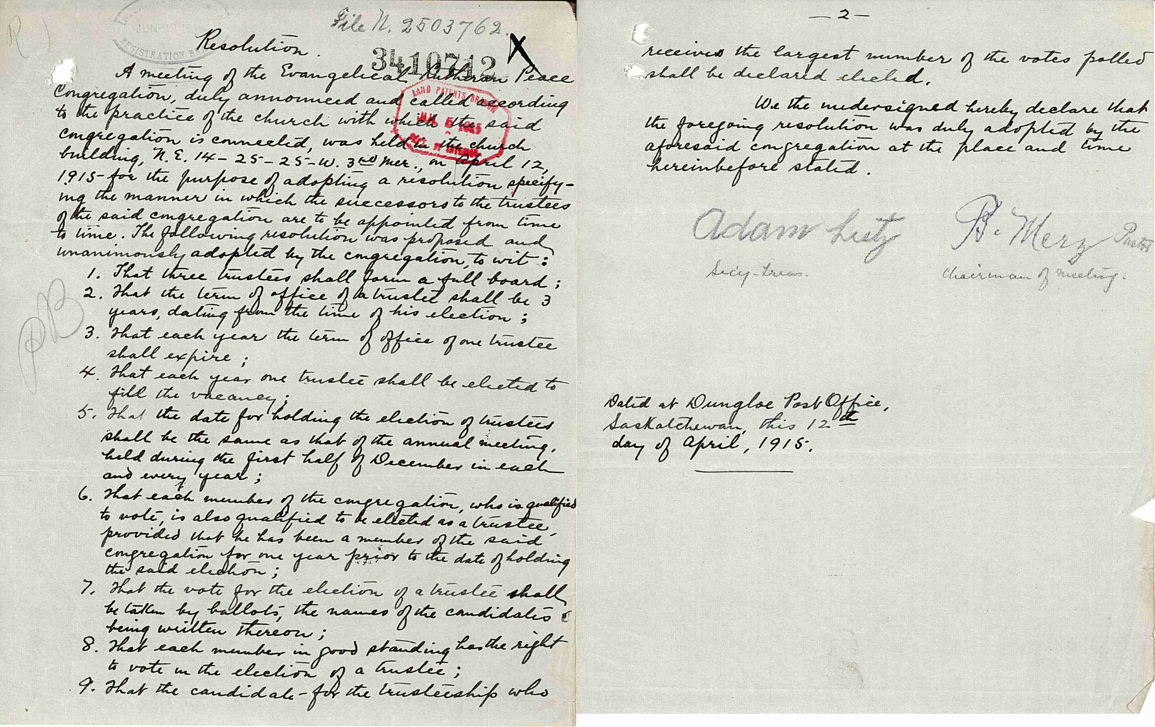
| 1915-Apr-12: Congregation's Resolution regarding election of Trustees. Much better. |
|
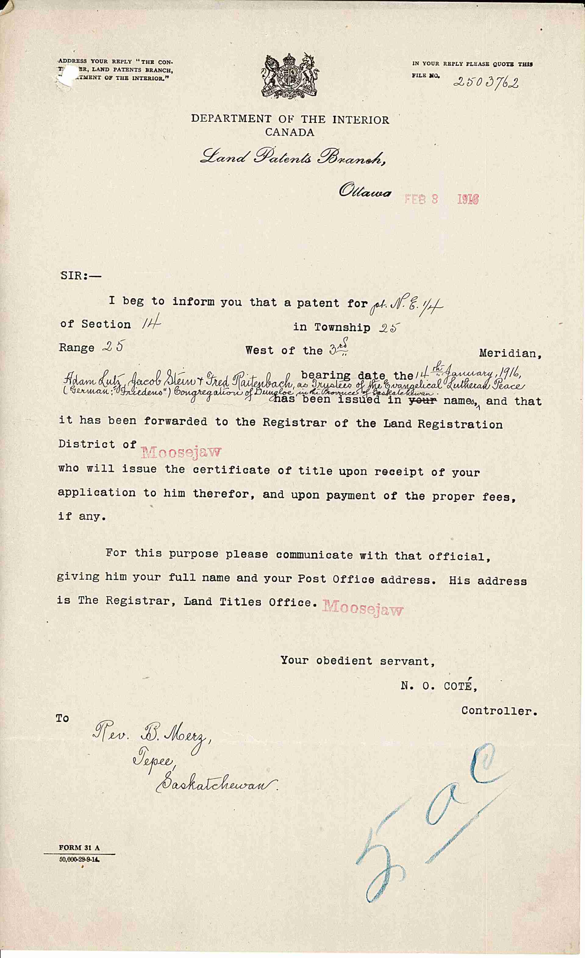
| 1916-Jan-14: Land Patent Grant issued for cemetery & church |
|
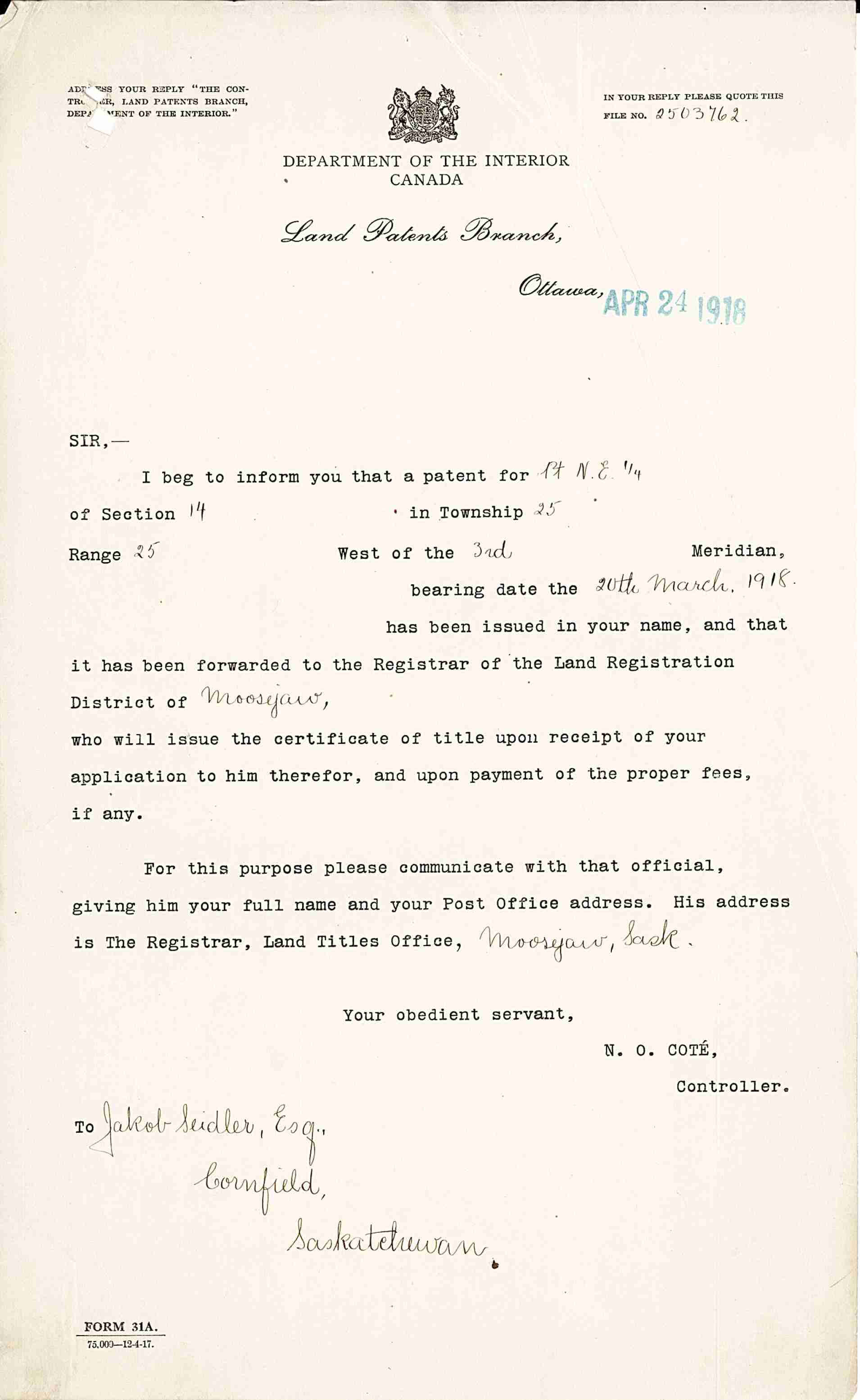
| 1918-Mar-20: Jakob Seidler Homestead Patent Grant for NE-14-25-25-W3. |
|
| 1921-Jul-01: Cornfeld Post Office closes and people have go to Eatonia for their mail. |
|
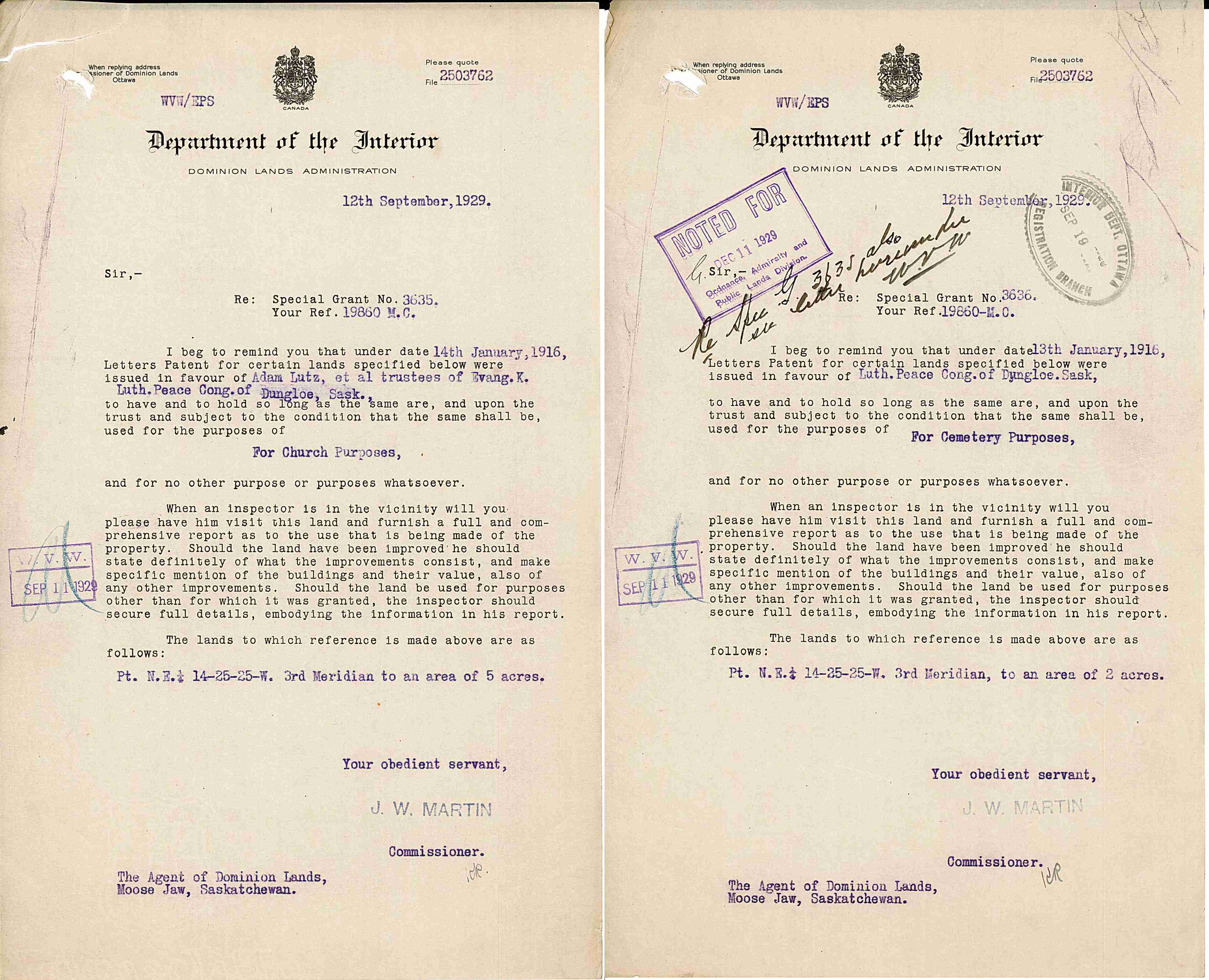
| 1929-Sep-12: Have an inspector visit and report on the church & cemetery lands. |
|
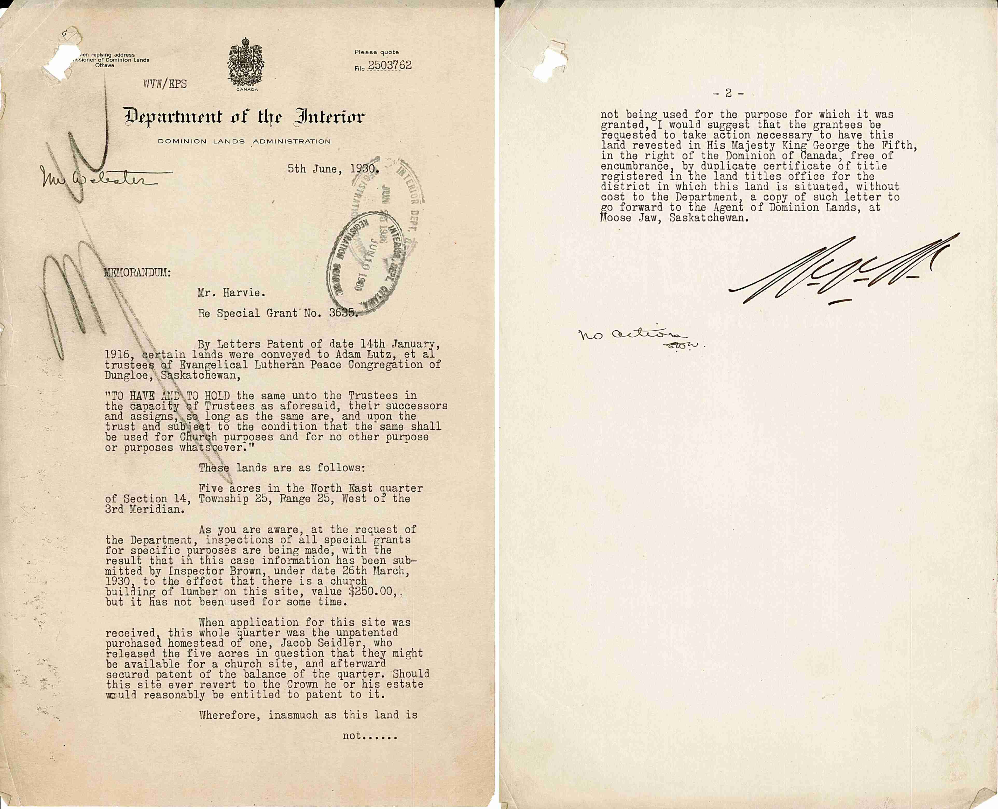
| 1930-Mar-26: There is a church, but has not been used for some time. 1930-Jun-05: The church & land is no longer being used for the purpose for which it was granted. Revert the land to the Dominion. |
|
| The Bruce's Graveyards group of websites are not monatized, meaning I do not make any money from these websites. There are no advertisements. Bruce A. Johnson - Empress, Alberta, Canada |
Do you have any corrections, concerns, questions, or comments? I'd happy to discuss them. |